Aerial Views of Ames
City of Ames GIS Aerial Views
Ames Now & Then, This Map compares Ames in 1930 and 2012
|
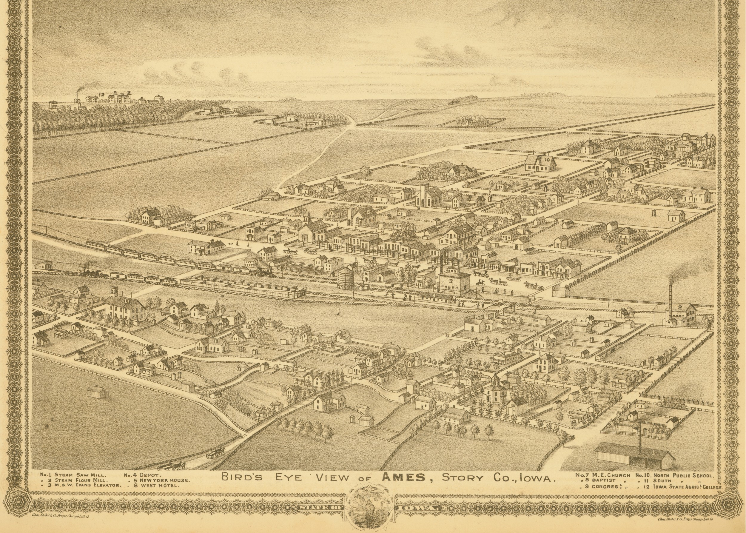
1875 Bird's Eye view drawing of Ames from Andreas Atlas looking northwest |
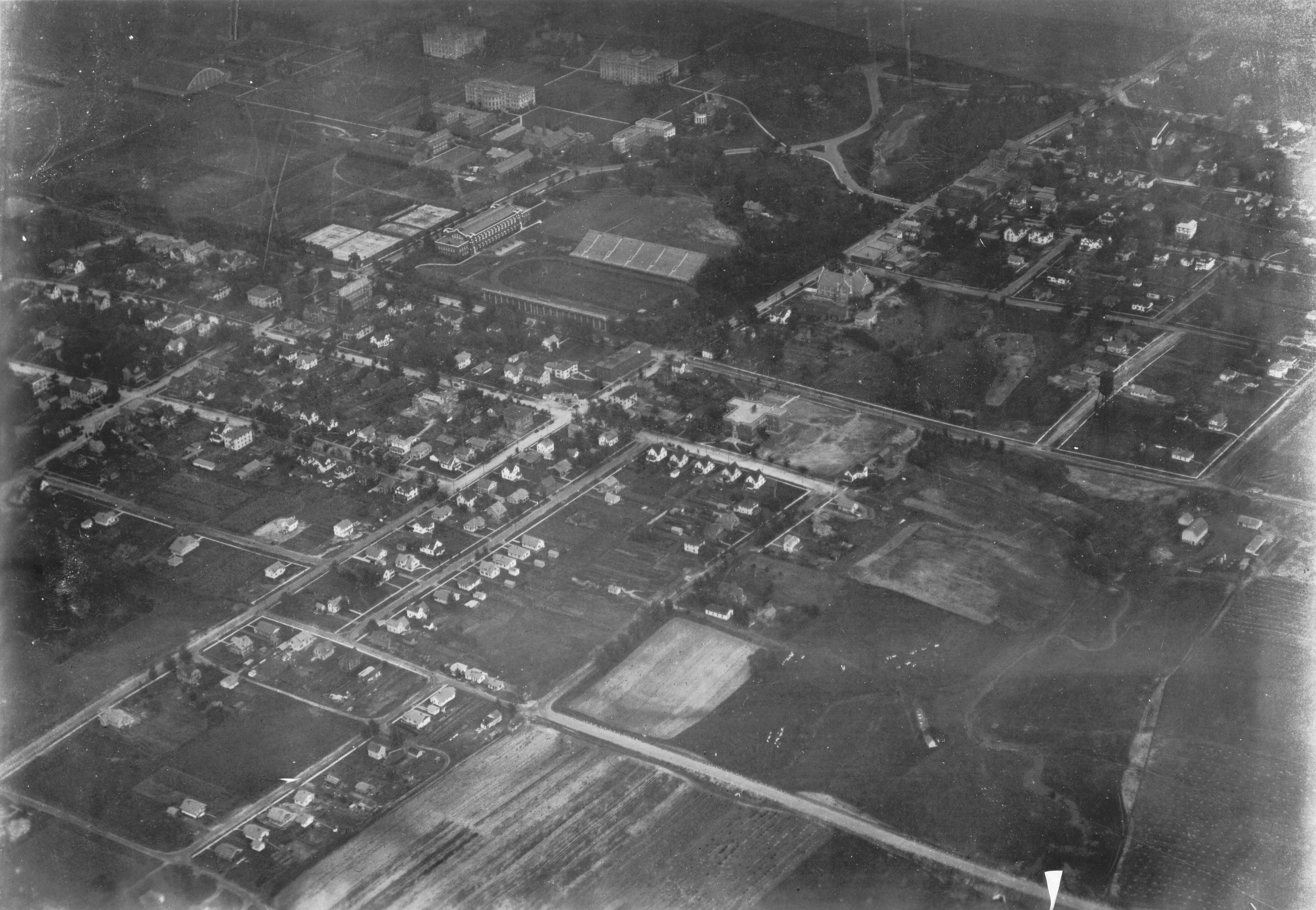
1926 west portion of campus and campus town area looking northeast |
|
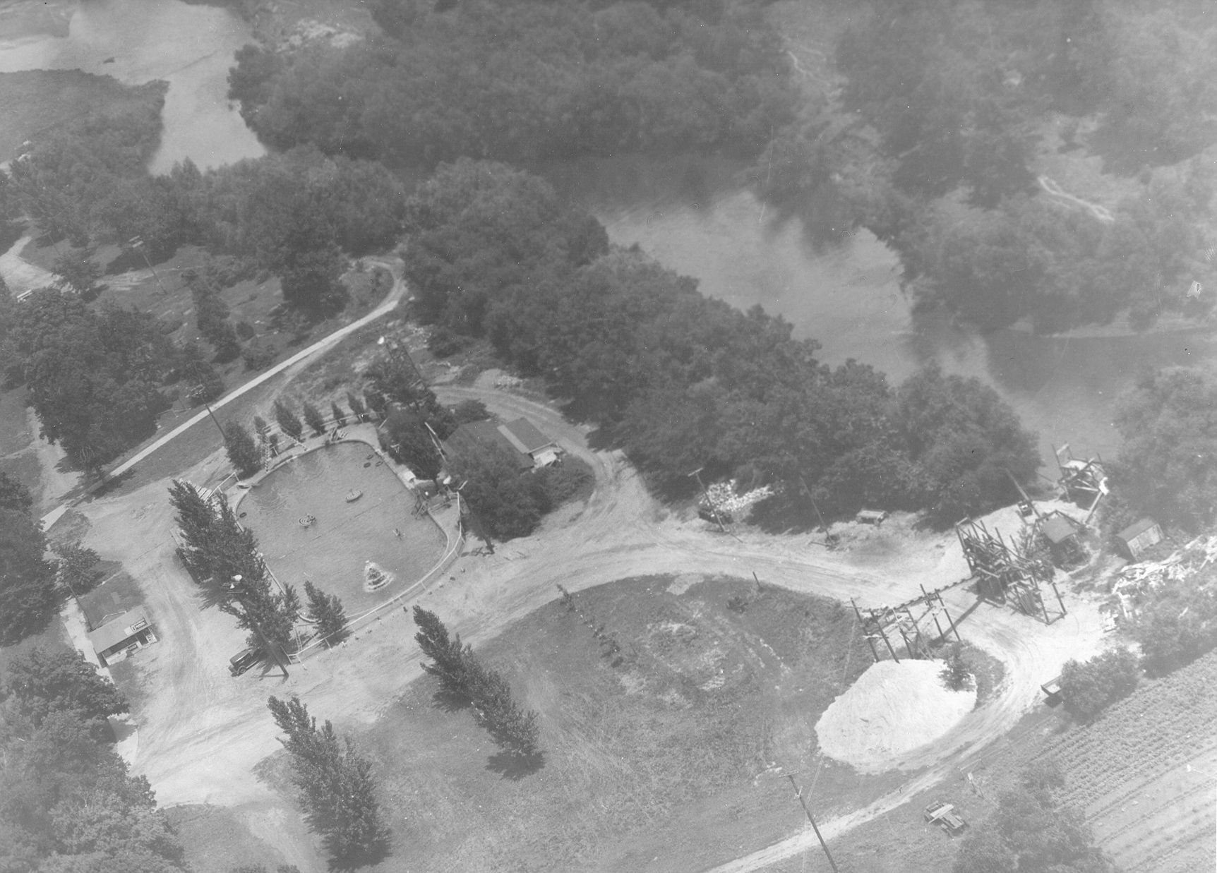
1930s Carr's Pool looking northeast |
1935 Campus view looking northeast |
|
1937 Lincoln Way and Grand Avenue intersection looking northeast |
1938 Campus View looking west |
|
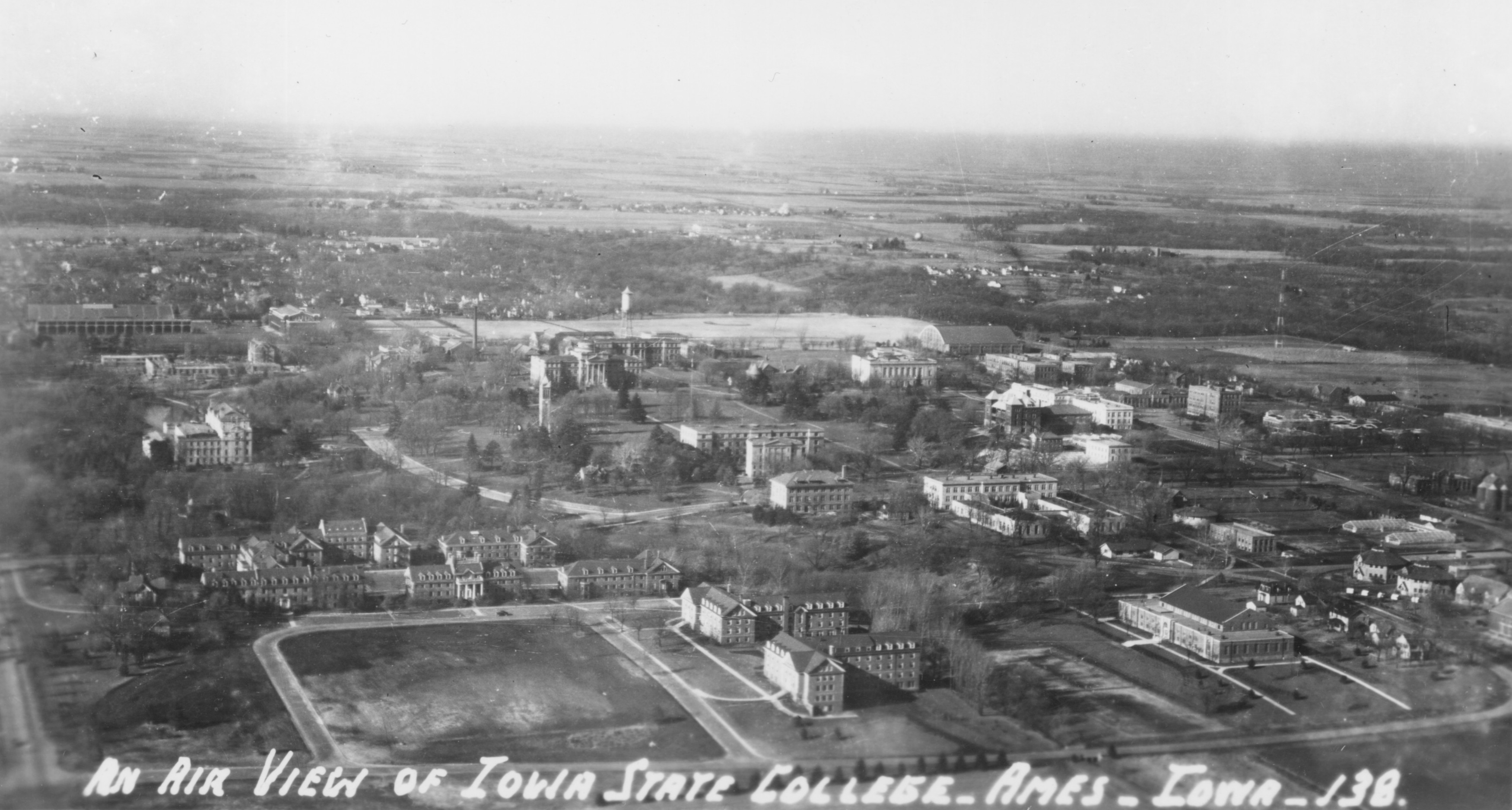
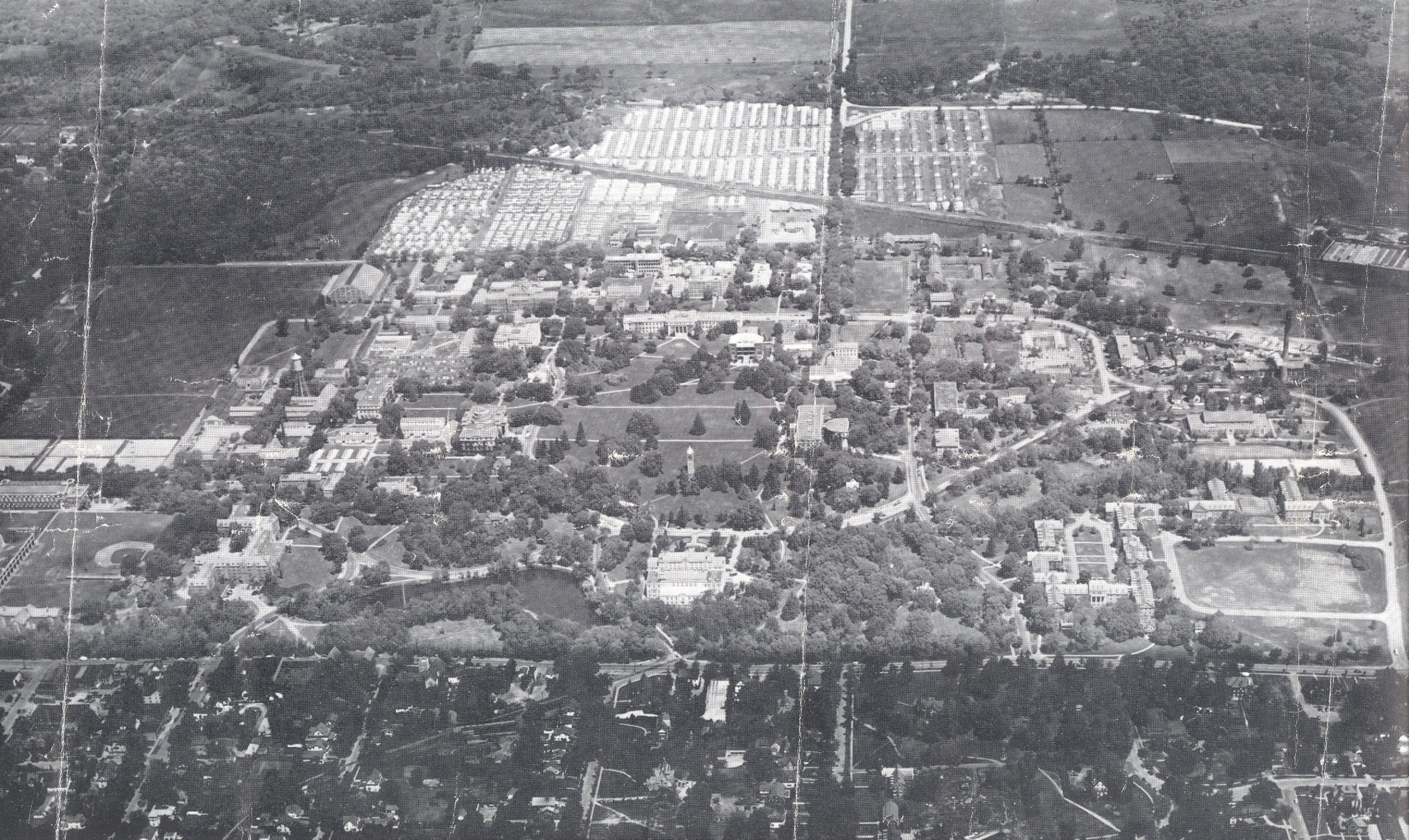
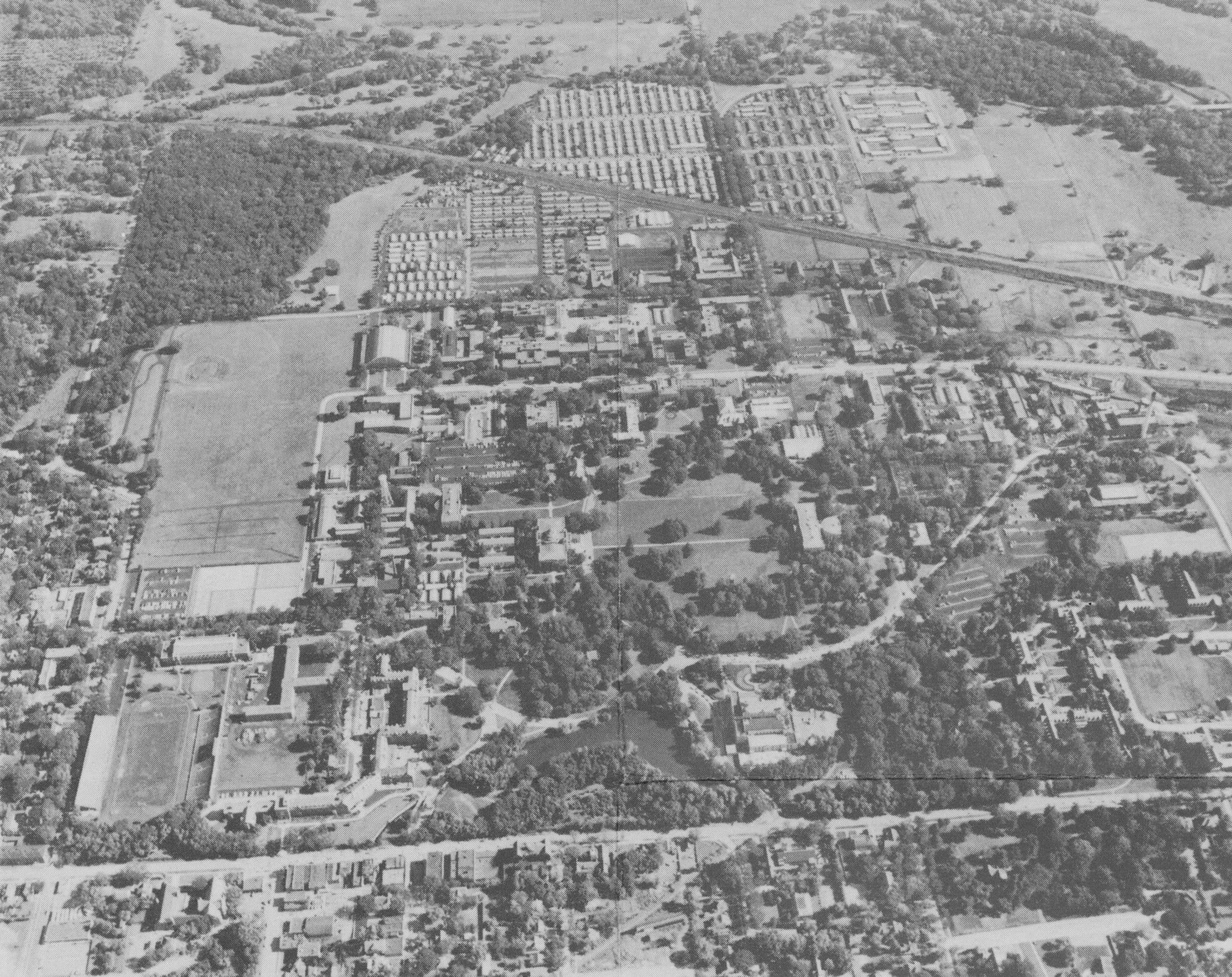
1938 aerial view of Campustown and Iowa State College looking northwest |
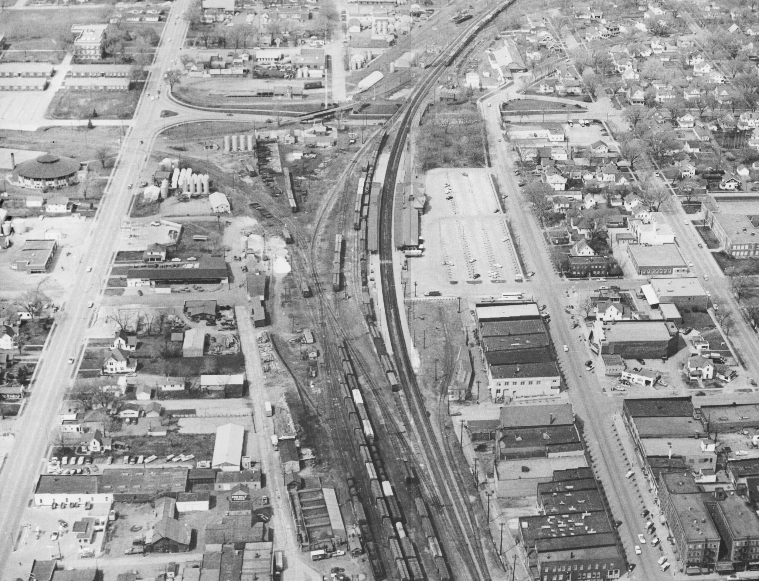
1938 view of Grand Avenue depot area looking north-northeast |
|
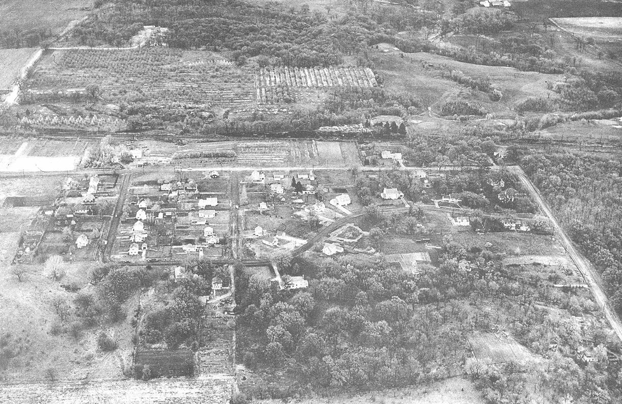
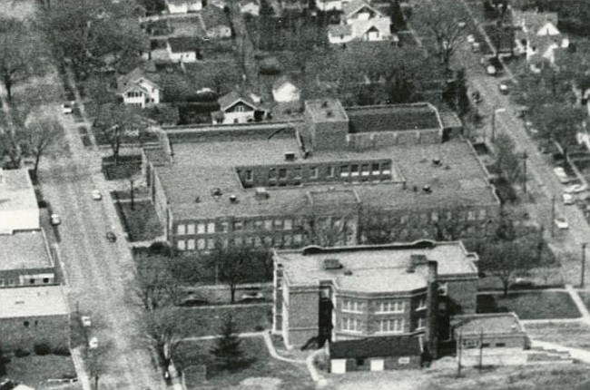
1938 aerial photo looking north from Ninth Street between Roosevelt Avenue, right, and Northwestern Avenue, Left. Roosevelt School, seen in the foreground, opened in 1924. |
1940 view of Ontario Road looking north |
|
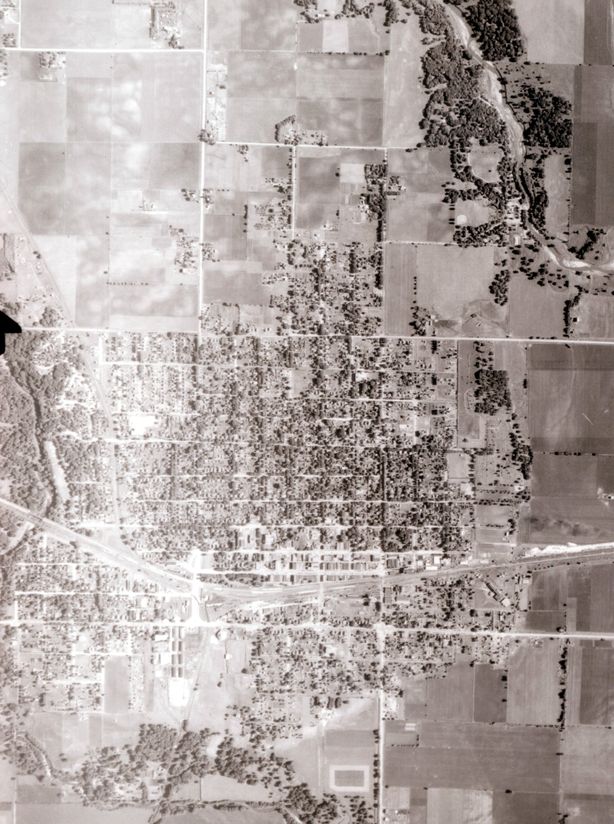
1939 aerial photo of Ames area east of Ioway Creek |
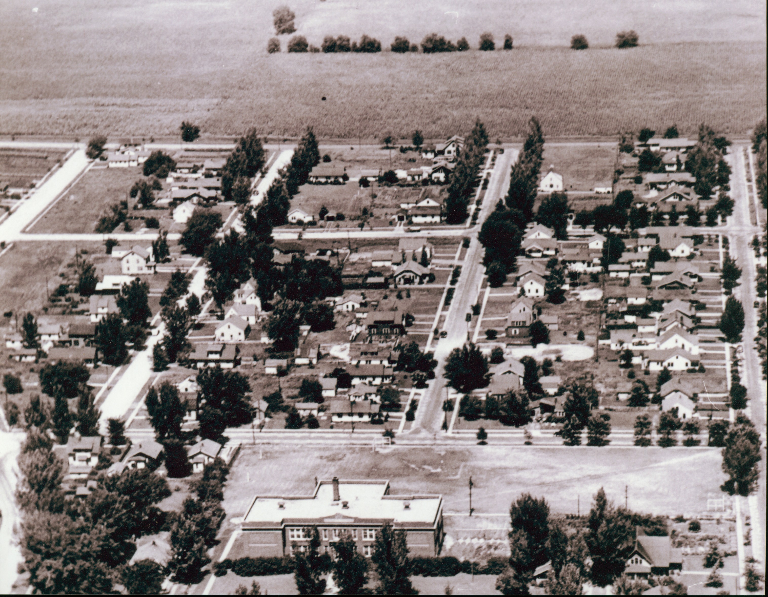
Mid-1940s view of Roosevelt School and Thirteenth Street area looking north |
|
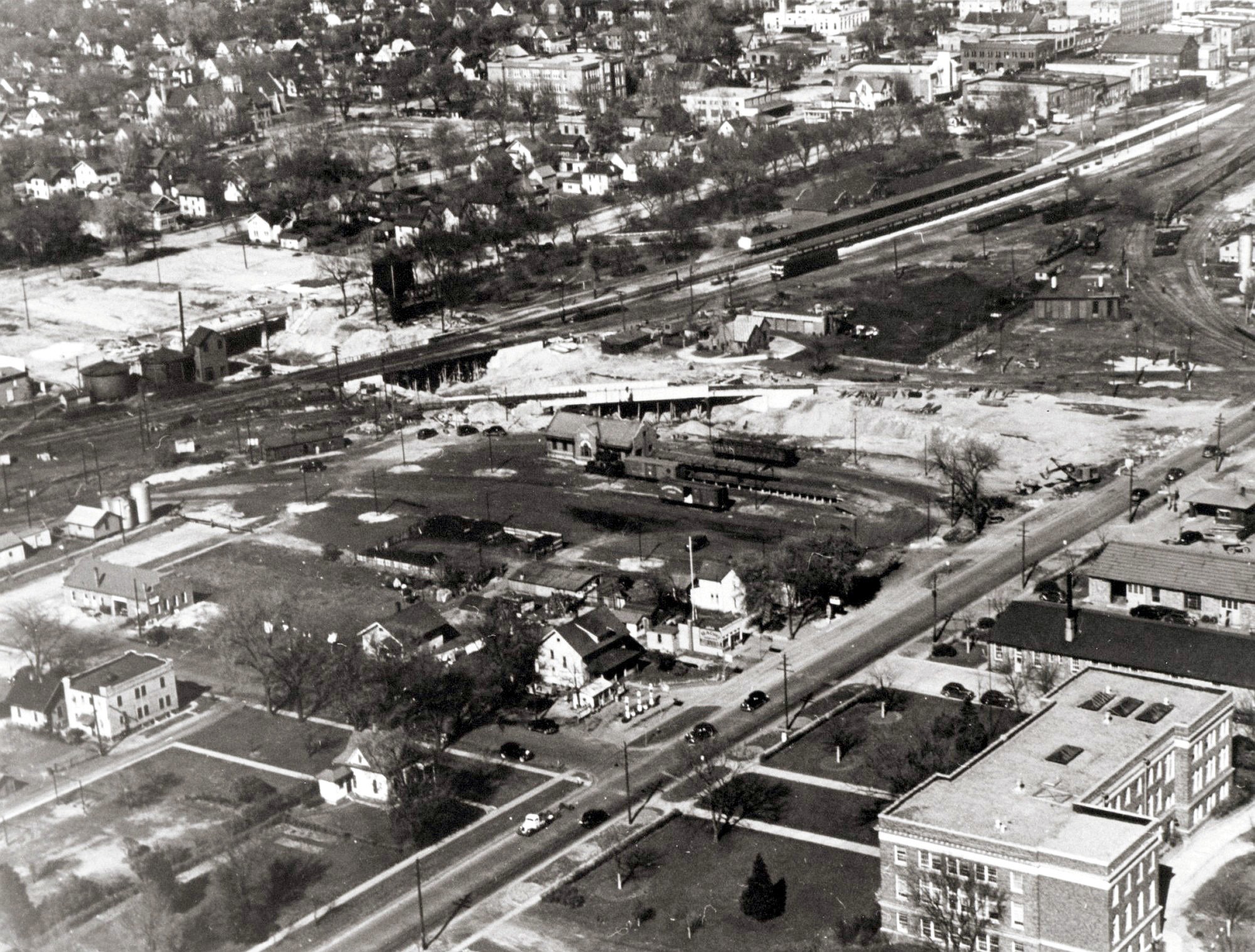
1948 aerial view of western end of Main Street looking west |
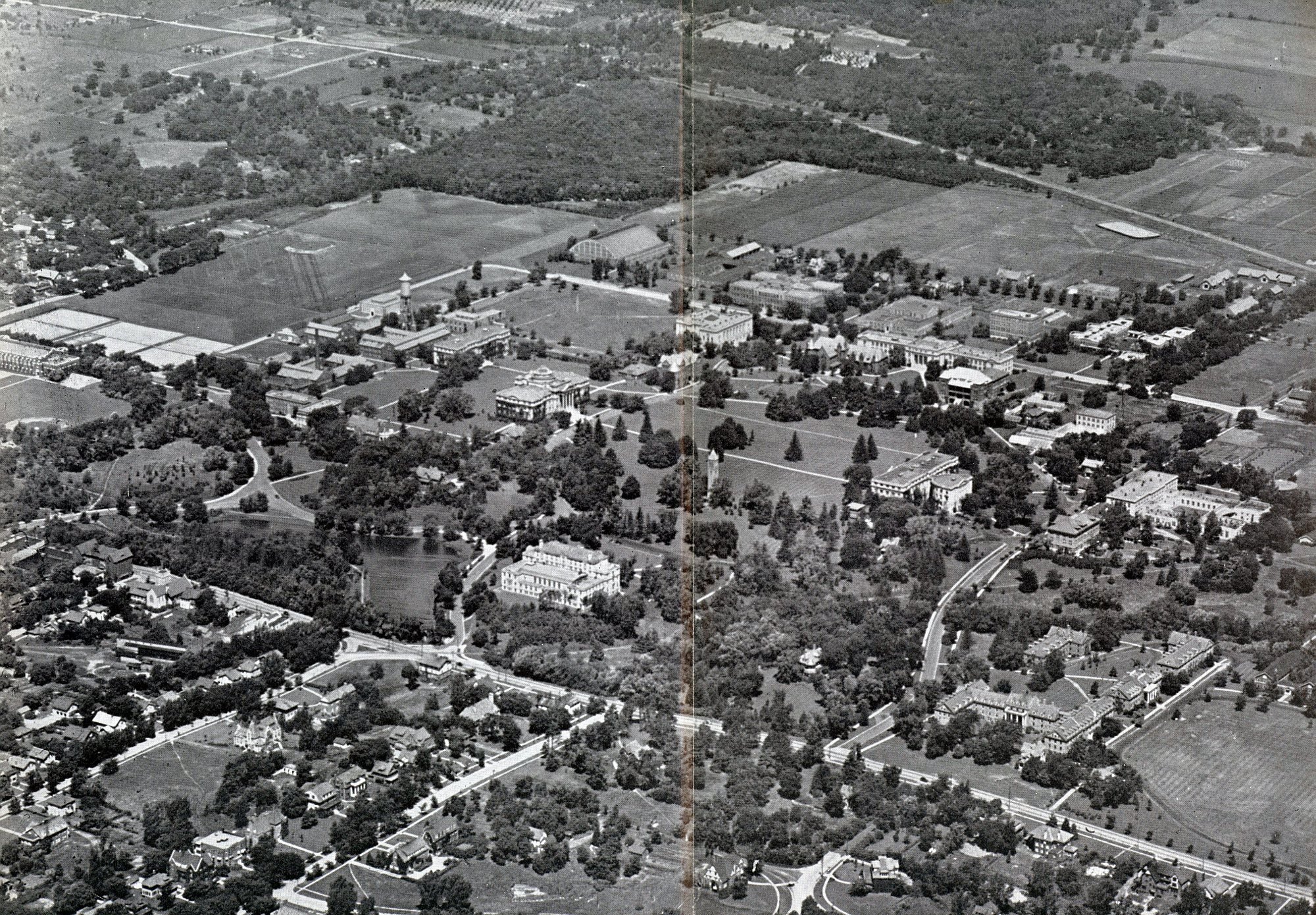
1948 Aerial photo of ISC Campus and Ames Campustown looking north |
|
1950s view of campus area looking north |
Ames High School area showing schools on both sides of Clark Avenue looking west |
|
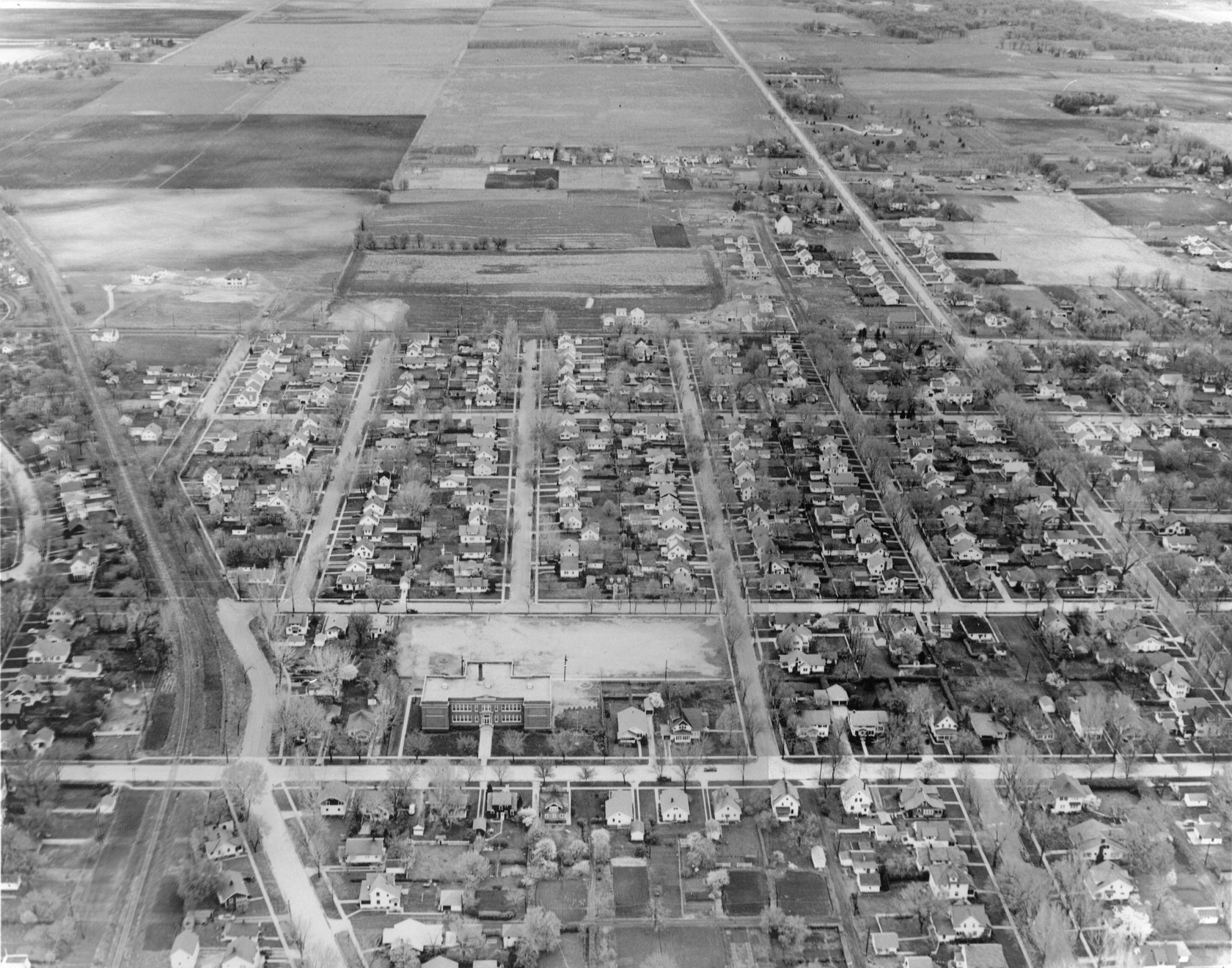
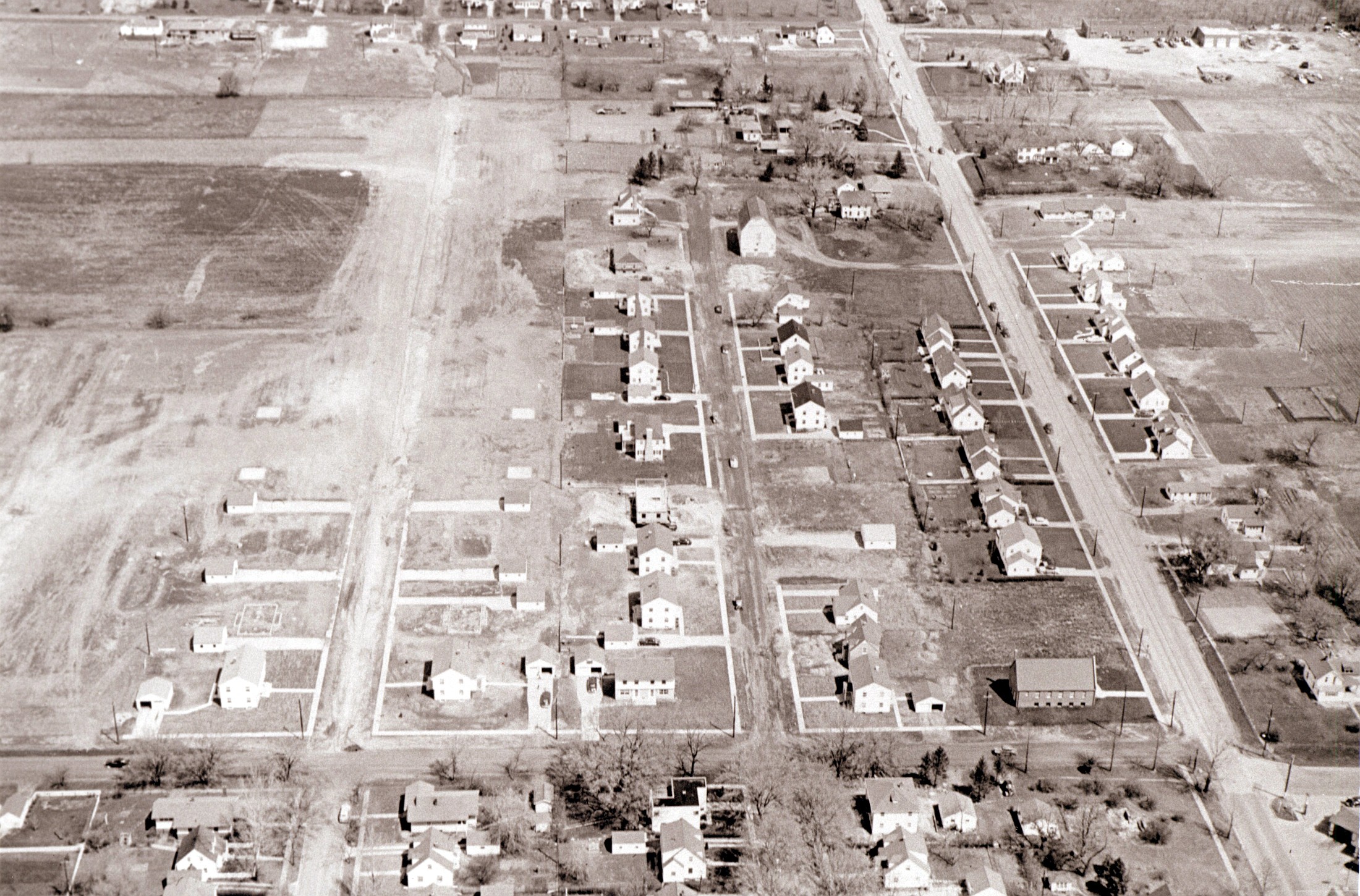
The 1951 aerial photograph facing north shows the residential development in Ames located north of Thirteenth Street and west of Grand Avenue. Note the Seventh Day Adventist Church, built in 1941, on the northwest corner of 13th and Grand. The former Knight's Pony Farm buildings can be seen in the upper right center.(Farwell T. Brown Photographic Archive) |
1953 aerial photo of Ames area east of Ioway Creek |
|
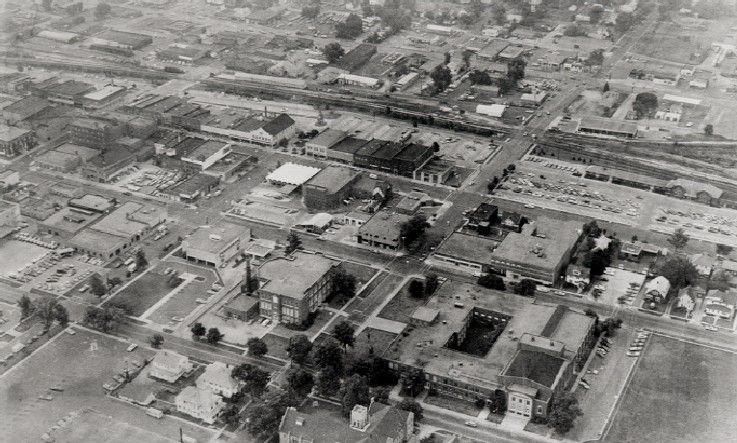
1950s aerial view of downtown Ames |
1958 aerial photo of Ames area east of Ioway Creek |
|
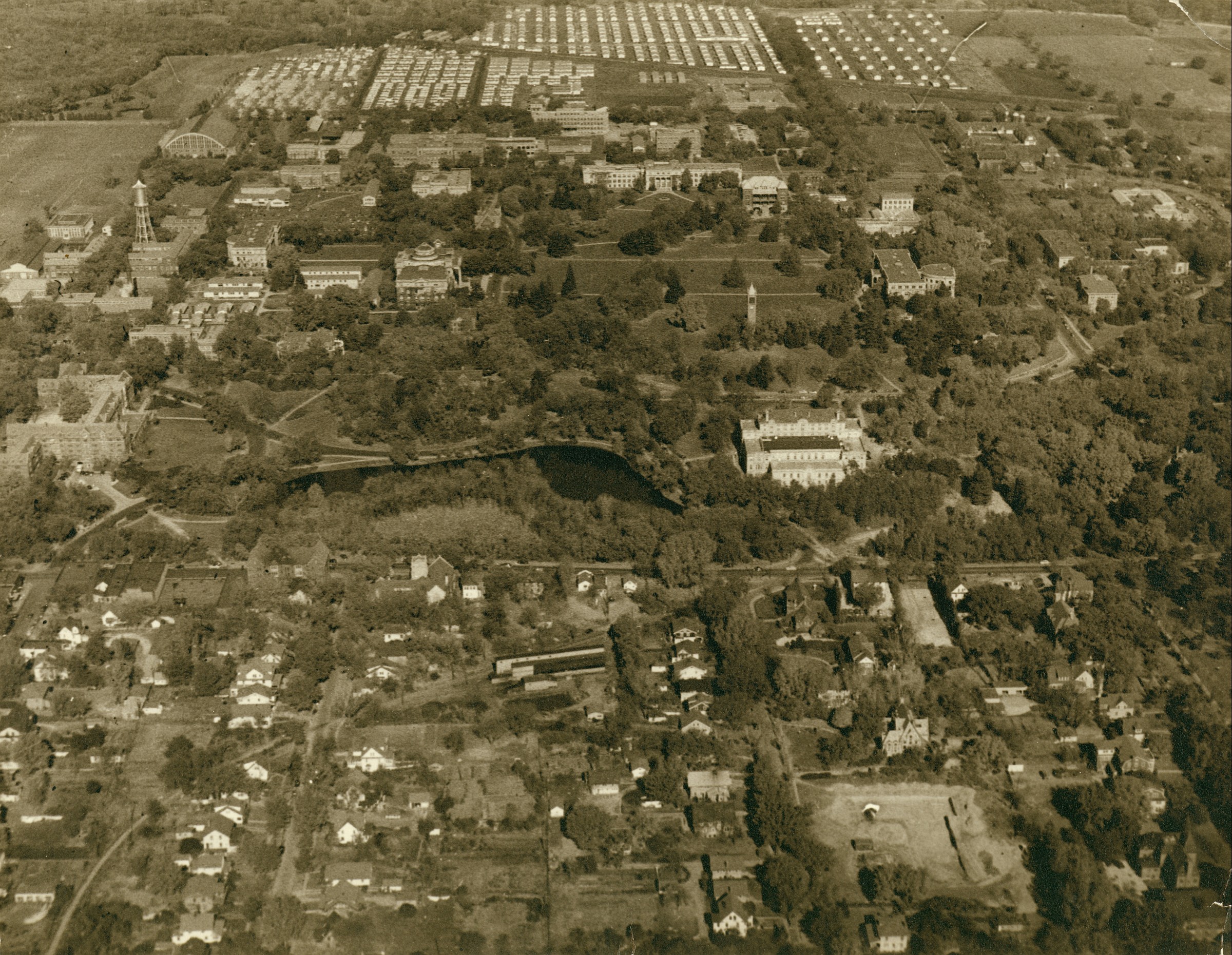
1958 Aerial view of ISC campus and Lincoln Way looking north |
1959 or 1960 view of Lincoln Way and downtown Ames |
|
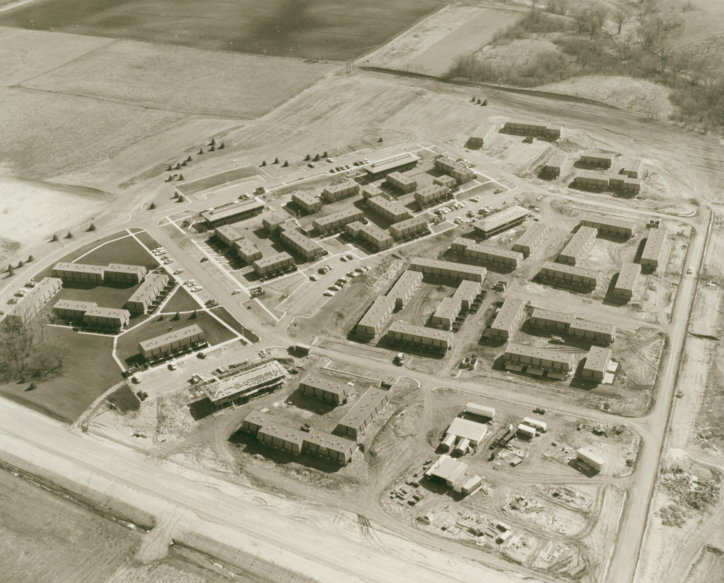
Aerial view of University Village when new, ca. 1960s |
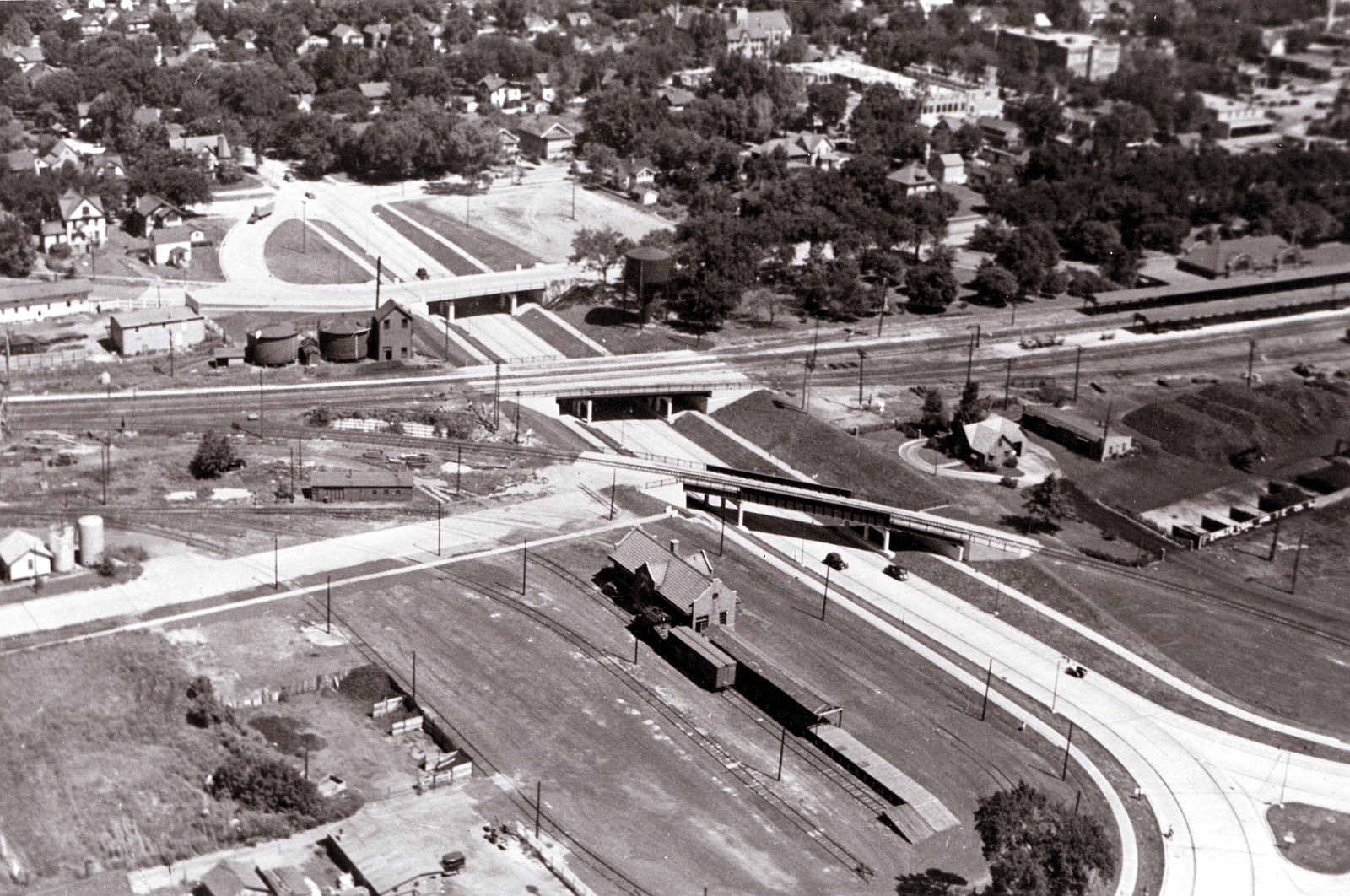
1960 DOT and Lincoln Way looking southeast |
|
1962 Aerial view of Beach to Ash Avenue south of Lincoln Way facing north |
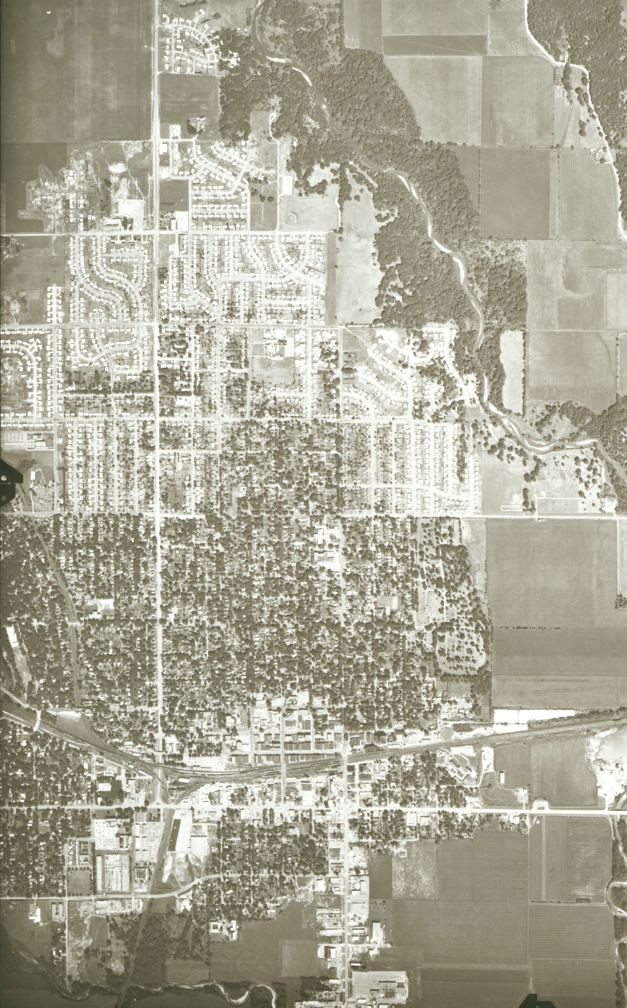
1965 aerial photo of Ames area east of Ioway Creek
|
|
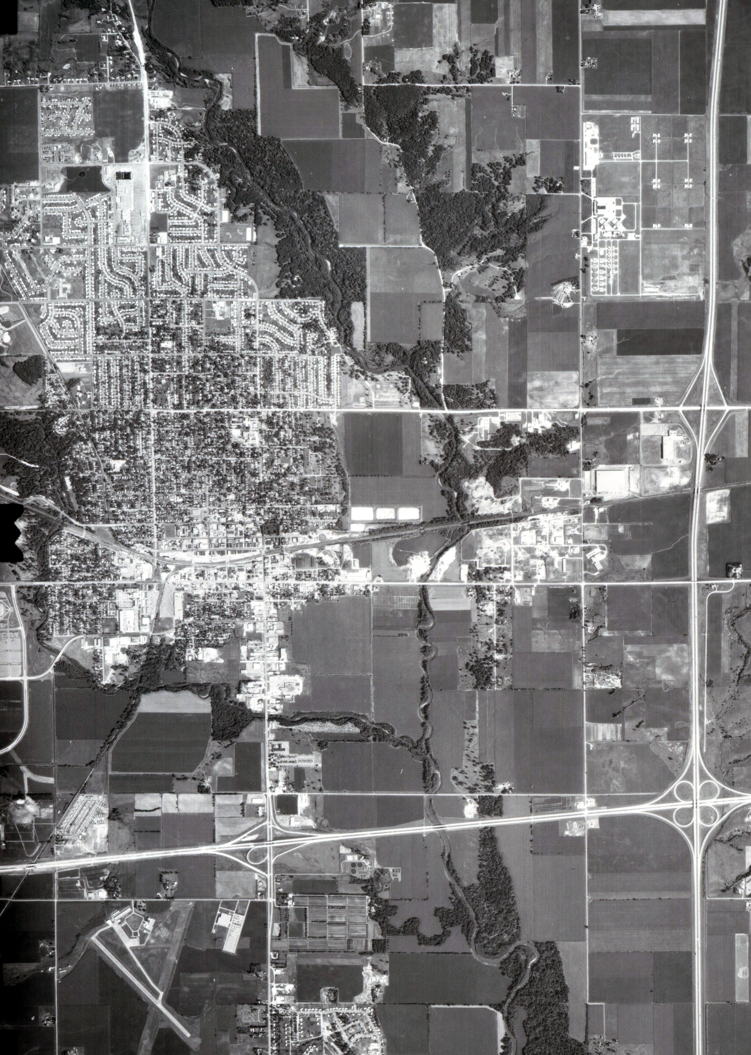
1972 aerial photo of Ames area east of Ioway Creek |
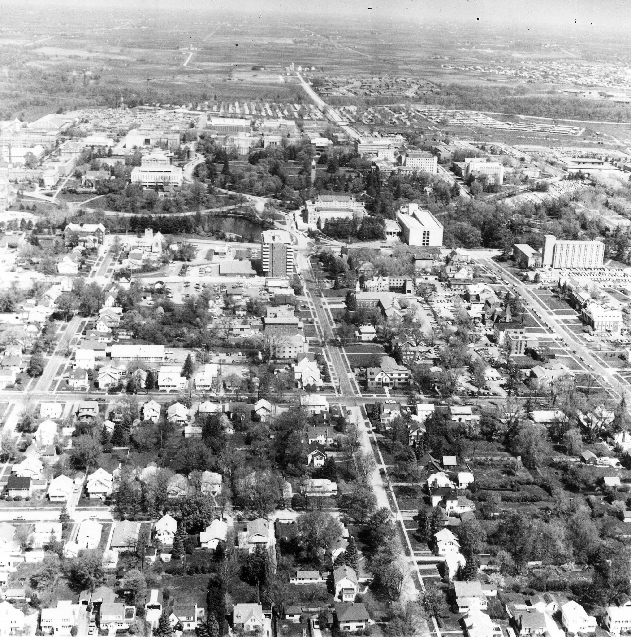
1975 aerial view of campus and campus town looking north |
|
1976 aerial photo of Ames area |
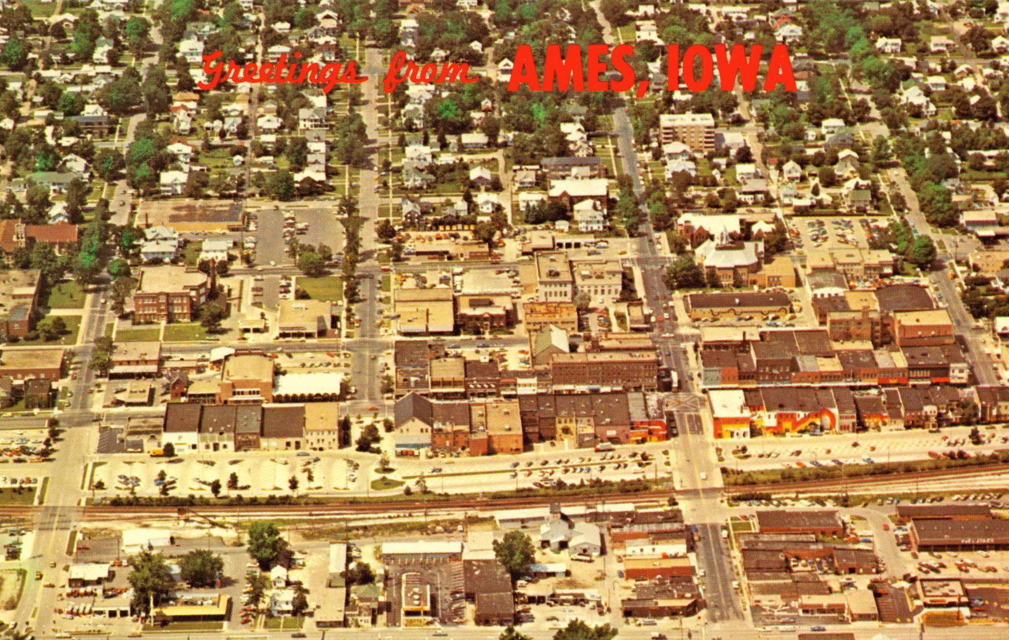
1976 postcard view of downtown Ames looking north with Lincoln Way visible at the bottom |
|
1976 view of Ames downtown looking southeast |
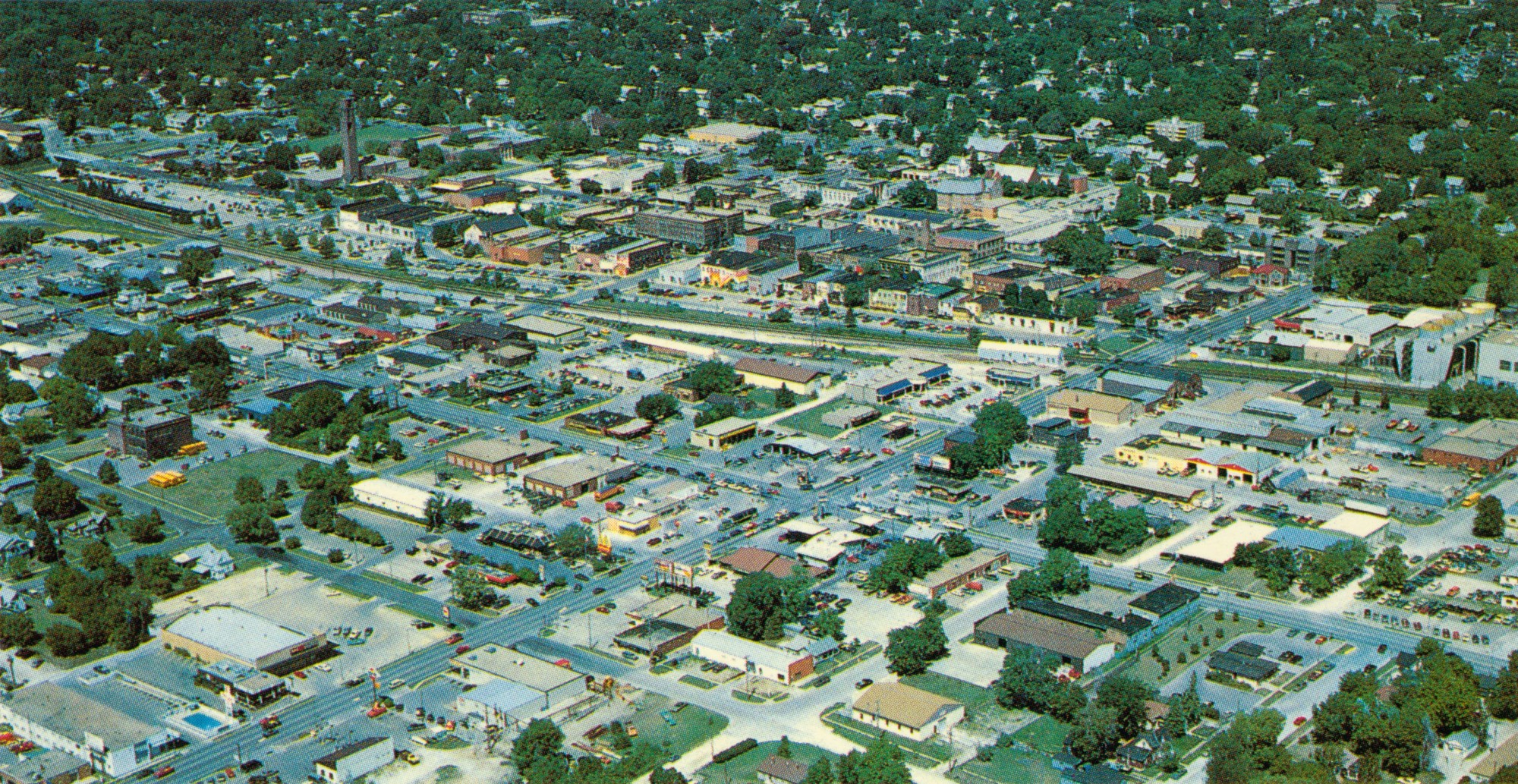
Postcard aerial of downtown Ames looking northwest, ca. 1980s |